 Plate 01
What a projection gives up
You cannot flatten a curved surface without tearing or stretching it. Every projection therefore preserves at most one of angle, area and distance, and wrecks the others — which makes the choice a statement about what the map is for.
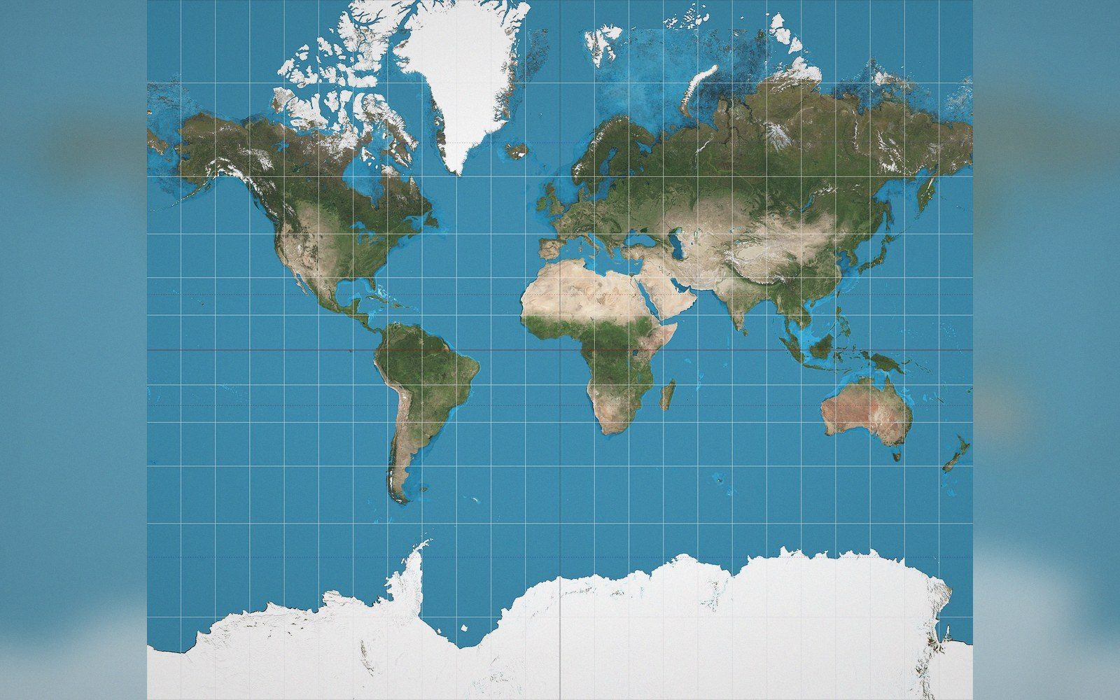
Mercator keeps angles, so a constant bearing draws straight — and inflates area with latitude until Greenland reads like Africa.
Photo: Mercator projection SW · Wikimedia Commons
Every flat map is a lie — the question is which one you can live with
Flatten an orange peel and you will find it tears at the edges or buckles in the middle. There is no way around this: the surface of a sphere has positive Gaussian curvature, and a flat sheet has none, and no continuous, unbroken mapping between the two can leave all distances, all angles and all areas simultaneously intact. Carl Friedrich Gauss proved this formally in 1827 in his theorema egregium — the remarkable theorem — and cartographers have been managing the consequences ever since.
The practical upshot is blunt. Every map projection preserves some geometric property at the cost of distorting others. The distortion is not a flaw in the execution; it is a mathematical certainty built into the geometry of the problem. What the cartographer controls is not whether distortion occurs, but where it accumulates, what form it takes and whether the intended use of the map can tolerate it in those places and in that form.
The three properties and what breaking them costs
Angle. A projection that preserves angles locally — that is, one in which the angle between any two lines at a point on the sphere is reproduced faithfully at the corresponding point on the plane — is called conformal. Circles small enough to be considered flat on the globe map to circles on the sheet. Shapes of small features are preserved, which makes conformal projections the natural choice for navigation: a straight line drawn on a Mercator chart crosses all meridians at the same angle, which is exactly what a compass bearing means. The price is area. On a Mercator projection the island of Greenland appears roughly the same size as the continent of Africa, yet Africa is about fourteen times larger. The area distortion is not a flaw in Mercator's arithmetic; it is the direct, unavoidable consequence of maintaining conformality across a global sheet.
Area. A projection that preserves area — so that a region covering one percent of the Earth's surface covers one percent of the map's area — is called equal-area or equivalent. Albers conic and the cylindrical equal-area projections belong here, as does Lambert azimuthal equal-area, which is widely used for thematic mapping of continents and hemispheres. Equal-area projections are the only honest choice when the map is meant to compare magnitudes: population density, land use, deforestation rates. Use anything else and a region that looks large will attract visual weight it may not deserve. The price of equal-area is shape. To keep areas true, the projection must squeeze and shear outlines, and the distortion of angles that results can make coastlines and borders look unfamiliar, particularly toward the edges of the sheet.
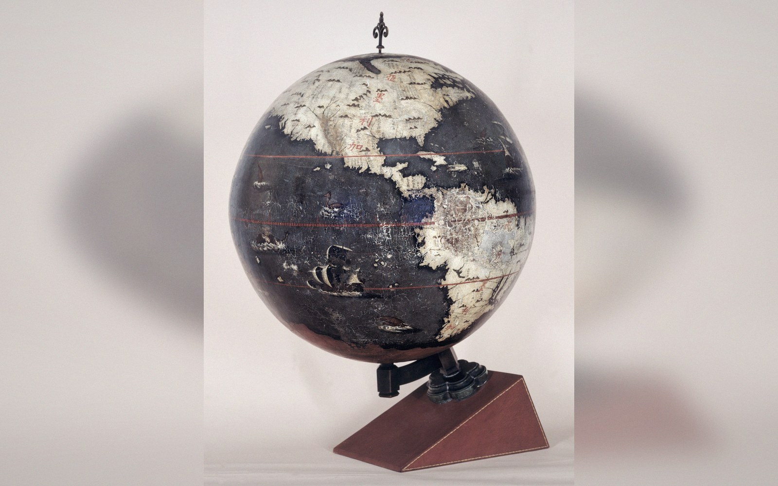 Plate 2
On a globe nothing has to be stretched. Every problem in this register begins when the surface is flattened.
Photo: Longobardo-Dias terrestrial globe · Wikimedia Commons
Distance. No projection can preserve distances in all directions from all points simultaneously. What is possible is to preserve distances along particular lines: along all meridians (the equidistant cylindrical), along one or two standard parallels, or from one central point outward in all directions (azimuthal equidistant). These are not equal-area and not conformal; they occupy a third family that trades a specific, limited promise about distance for greater control over the remaining distortions. Equidistant projections appear frequently in atlases, air-distance diagrams and any context where the reader needs to compare radial distances from a known origin.
The three families do not overlap. A projection cannot be both conformal and equal-area — Gauss's work on curvature shows that the two conditions cannot both hold for any map of the sphere. A projection that preserves distances along all meridians is neither conformal nor equal-area in the general case. Conformal, equal-area and equidistant projections form three genuinely separate families, and no amount of clever parameterisation collapses them into one.
Where the distortion goes and why it matters for the choice
Distortion is not distributed evenly. Every projection has lines or points of zero distortion — where the mathematical surface touches or intersects the globe — and distortion grows as you move away from those lines. On a cylindrical projection tangent at the equator, the equatorial belt is accurate and the poles are catastrophically stretched. Tilt the cylinder to touch along a meridian and you get a transverse projection accurate along that line and badly distorted ninety degrees away. The sixty-zone UTM grid is built on exactly this logic: use a transverse Mercator, confine each zone to six degrees of longitude, and the distortion across that narrow strip stays small enough to ignore for most engineering purposes.
The practical lesson is that the projection choice should be driven by the geography of the mapped region and the nature of the data. A narrow east–west country fits a conformal conic well; a dataset of choropleth rates demands an equal-area base; a polar region makes a cylindrical projection nearly useless. The question to ask is not which projection is most accurate in some general sense, but which geometric property the map's purpose actually requires, and then which projection delivers that property with its distortion pushed away from the regions that matter.
Thematic maps that show quantities — any map whose message depends on how much of the Earth's surface a phenomenon covers — are obligated to use equal-area projections. This is not a stylistic preference. A choropleth on a Mercator base systematically over-represents high latitudes and under-represents the tropics, and because human visual attention tracks area, the distorted sheet distorts the reader's intuition about magnitude. The error is invisible to the reader, which makes it worse.
Conversely, a navigator working with bearing lines, a surveyor measuring angles between landmarks, or an engineer projecting coordinates into a local grid all need conformality. Distorted areas are irrelevant to them; distorted angles are not.

The Tissot indicatrix is the standard tool for visualising what a projection does across its whole extent. Place identical small circles at regular intervals across the globe; project them; measure the ellipses they become. The ratio of the ellipse axes records angle distortion, the area of the ellipse records area distortion, and the orientation records shear. Reading an indicatrix teaches more about a projection's behaviour in five minutes than any written description can.
The choice as a statement of intent
Choosing a projection is a declaration about the map's purpose, whether the mapmaker intends it as such or not. A wall map of the world on a Mercator projection, displayed in a classroom, tells viewers that shape matters more than comparative size — and in a classroom context, that is usually wrong. An equal-area projection on the same wall makes a different statement: the areas are honest; judge the magnitudes accordingly.
What the projection gives up is therefore not a technical footnote. It is the first editorial decision the cartographer makes, logically prior to colour choice, classification scheme or labelling style. Get it wrong and the rest of the design effort rests on a crooked foundation. Get it right and the map's geometry quietly supports every argument the data is making, without the reader ever having to notice.
Also in Projections