 Plate 01
Where a coordinate comes from
Every position is measured from something else. The chain ends at a physical mark somebody set in the ground.
Photo: Ferhat Kocakaya / Pexels
From observation to number
A coordinate looks like pure information — a pair of numbers, clean and self-contained. It is not. It is a measurement relative to a prior measurement, which was relative to another, stretching back through a hierarchy of field observations until you reach a physical object: a bolt set in bedrock, a brass disk in a pavement, a chiselled arrow on a stone bridge. The number only means what its ancestry means.
The hierarchy has a name: the control network. National geodetic agencies — the U.S. National Geodetic Survey, Great Britain's Ordnance Survey, Germany's AdV and their counterparts worldwide — establish a skeleton of precisely measured points across their territory. Everything else is measured from that skeleton. A surveyor in the field does not measure from the centre of the Earth; she measures from the nearest control point whose coordinates she trusts, and extends outward from there. Her instrument records angles and distances; geometry converts those into coordinates in the same reference frame as the control.
That frame matters as much as the measurements within it. The same physical spot has different coordinates in NAD27 and NAD83, or between the British National Grid (OSGB36) and its ETRS89 replacement — not because the ground moved, but because the reference frame was redefined. Continental-scale adjustments sometimes shift positions by tens of metres. A coordinate without its frame attached is genuinely incomplete, not merely imprecise.
The chain of trust
Modern GNSS — GPS, GLONASS, Galileo, BeiDou — appears to bypass the control network entirely. It doesn't. The satellite orbits are computed in a global reference frame maintained by the International Earth Rotation and Reference Systems Service; the frame itself is anchored by a worldwide network of continuously operating reference stations whose positions are known to millimetre precision. When a receiver in the field computes a position, it is reading a chain that leads through space to those ground stations, and through them to the physical marks that were measured when the network was established.
Differential and network-RTK techniques make the dependency on ground infrastructure explicit. A rover computes its position relative to a base station, or relative to a continuously operating reference station network. Trim the chain at any link and the precision can still look impressive — centimetric scatter in repeated readings — while accuracy against precision diverges silently. The coordinates are consistent with each other but not with the world they purport to describe.
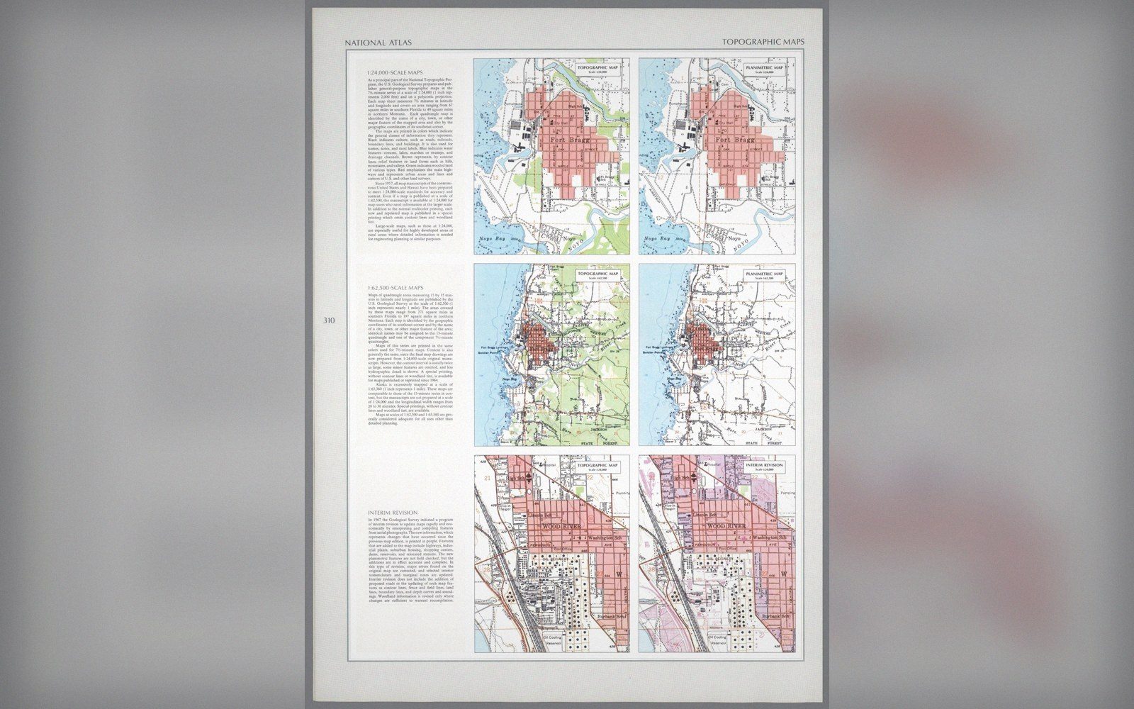 Plate 2
The same ground published twice, with contours and without. What a sheet leaves out is a decision about its purpose.
Photo: Topographic and planimetric sheets, Fort Bragg · Wikimedia Commons
Error also propagates. A control point with a coordinate correct to five centimetres cannot supply a derived observation correct to one. Each subsequent measurement adds its own uncertainty, and those uncertainties compound. Long traverses, or chains of vectors in a GNSS network, accumulate misclosure that network adjustment must distribute. The adjustment does not eliminate error; it spreads it in the least harmful way the mathematics can manage, given the redundant observations available.
What the mark actually is
At the bottom of every chain is a physical object that someone placed deliberately, described in writing, and intended to be found again. That is what a survey mark is: a shared assumption made concrete. The description matters as much as the mark itself. A bolt on a rock outcrop can be found a century later; a stake in a field cannot. National monumentation standards specify material, depth, placement context and recovery information precisely because a mark that cannot be found is useless regardless of how well it was measured.
Marks are also revised. Control networks are periodically readjusted as better observations accumulate, as plate motion carries points in predictable directions, or as a new global frame is adopted. When the NGS published the NAD 83 adjustment, it superseded NAD 27; when it moves toward its next-generation reference frame, positions will shift again, modestly but measurably. The mark in the ground does not move — or moves only with the earth beneath it — but its published coordinates are an agreement about how to interpret that position within the current framework of knowledge.
Every derived coordinate inherits that agreement. When a GIS layer comes without a stated datum, the chain is broken: you have numbers but not their meaning. The mark in the ground remains; what's lost is the path connecting your data to it.

Also in Survey & Measurement